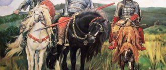
Essay on the topic of Mountain Altai
First, let's get to know each other better; in fact, I am Juno. My name is Yulia, but I’ve been using my nickname online for 12 years, so I’ve become close to it, and many friends call me Juno, my husband Alexey and my two princesses – the younger Vasilisa and the eldest Elizabeth. And also my friend (alas, already ex, Svetlana and her daughter, also a former friend, of my eldest daughter, Alinka) took part in this trip. So, the first day, Friday, 5 a.m. on August 7 , we are driving along the M-52 highway to side of the Altai Mountains, through the city of Biysk. Our first stop is a tribute to the memory of Mikhail Evdokimov, our former governor and simply a good person and a wonderful artist, because 4 years ago (this is in 2009) ago, on this very day, he died, this is the place of his death. Previously, there was one birch tree in this place, which caused its death, but now there is a beautiful chapel with an icon that is crying (some photographs from this place were taken in other years). After breakfast there, we moved further towards the Altai Mountains! On the way, we decide that we will first get to Chemal, look at the Chemal hydroelectric power station and the island of Patmos, and after that we will look for a place to stay for the night. But, having arrived at the place, we completely forgot about the church on the island of Patmos, and on this day, except for the Chemal hydroelectric power station and the junction of the two Chemal rivers (it is gray and the junction of the two rivers Chemal (it is gray) and the Katun (it is turquoise), nothing We didn't see it! After walking around the Chemal hydroelectric power station to our heart's content, taking pictures, walking through the souvenir shops... and having bought a few souvenirs as a souvenir, we went to the parking lot that we liked on the way to Chemal. The place turned out to be good (on the banks of the Katun), with a large clearing , gazebos and guarded, which was very convenient for us, since while walking in the souvenir shops on Chemal we bought a glass coaster with a map of the Altai Mountains with its passes printed on it, and it was decided that tomorrow we would go to the passes! , we went to Katun and swam a little, or rather we didn’t even swim, since the water in Katun is freezing, we just poured water on ourselves. And of course, we took a photo for memory. In the evening we sat by the fire... It was amazingly beautiful and big in the sky the moon, and its radiance made it very light! Second day. 6 a.m., August 8. I got up before everyone else. Surprisingly, I didn’t get cold at all in the tent at night, made a fire, made everyone breakfast and started waking everyone up. They didn't want to get up at all!!! Having somehow gotten everyone to sleep, had breakfast, we cleaned up everything in the tents and headed towards the Chuysky tract. At 9-30 in the morning we first cross the bridge over the Katun... And we drive further into the depths of the Altai Mountains, along the federal highway of the Chuysky Tract... The further we drove along it, the more beautiful nature became: The only thing that upset me was that my youngest daughter began to get motion sickness... and I had to stop almost every kilometer... The Seminsky pass began... I didn’t see anything special about it - there was a long road up the mountain, with not very good asphalt. Here's a little about the Seminsky Pass, as they say, for reference: The Seminsky Pass is a popular place among tourists and vacationers. This is also the highest point of the Chuysky tract. Its height is 1894 m (according to other sources 2200 m) above sea level. The ascent to the Seminsky Pass is 9 km long, and the descent is 11 km. The old Altai name for the Seminsky pass is “Dyal-Menku”. To commemorate the 200th anniversary of the entry of the Altai Mountains into Russia in 1956, a memorial obelisk was erected at the highest point of the pass road through the Seminsky ridge. From here you can see a picturesque panorama of the blue Altai, Mount Sarlyk (2507 m), and a cedar grove. From the Seminsky pass an 11-kilometer descent begins into the valley of the Ursul River, to the village of Tuekta. Previously, the road through the old Seminsky Pass was to the right (about 10 km) and descended into the upper reaches of the Peschanaya River, and then through the small Kamennaya Sedlo pass it went out to Lake Tenginskoye and the village of Tenga. The Seminsky Pass is a kind of border between “organized-civilized” and “wild-exotic” tourism. The gray-haired old man Altai comes into his own, and you are invited to his mountain domain! As we climbed the pass, our car made a strange sound... We went out to see what was wrong with our swallow, having examined it from all sides and seeing that everything was fine with it, we moved on and passed the stele - the highest point of the pass! It was decided that we would take a photo near her on the way back. And this is on the descent of the pass - we stopped again, because the child felt bad again... at the same time we took pictures of nature... The worst part of our journey has ended! Firstly, the child felt better, and secondly, the road became beautiful and smooth again! We reach almost the village of Ongudaya. Here everyone got out of the car to warm up a little, read information about this area, and at the same time take a photo by a small mountain river (I don’t remember its name). We washed ourselves in the river, drank cool water from it, and drove on. About 10 minutes later we arrived at a sign that marked the beginning of a new pass called Chike-Taman. A little earlier, we saw a road in the mountains and thought - it would be great to get there! We didn't even know. that in a couple of minutes we will be exactly there! Well, the Chike-Taman Pass has begun. Chike-Taman Pass The Chike-Taman Pass is located on the Chuysky tract, beyond the Seminsky Pass. The height of the Chike-Taman pass is 1460 m, but due to its steepness it seems much higher. For those who drive through this pass for the first time, the steepness of the climbs, the sharply winding road, the steep cliffs on the sides and the opening mountain panoramas are simply breathtaking! Photos do not convey even a hundredth part of the sensations of moving along mountain serpentine roads. But, despite all its entertainment, “Chike-Taman” is translated from the Altai language as “flat sole”! The northern slopes of Chike-Taman are completely covered with maral forest. In early spring, yellow Altai tulips bloom on the southern slopes. In the area of the Chike-Takan pass, the Chuya tract in former times was very difficult and dangerous for horses, for which it was cursed more than once by the coachmen, “This is not Cheketaman, but the Devil Ataman, forty-eight sins.” This says it all, pours out all the bile of a man who swore to the utmost, who tortured himself and killed, perhaps, more than one horse here. On the Chike-Tamana saddle there is a larch tree with white rags tied on its branches. This is the so-called shaman tree, which in the Altai Mountains can be found on passes, near streams and springs. Travelers have long tied ribbons in gratitude to the spirits of the place and in memory of those who stayed at home and who are waiting ahead. Major repair work on Chike-Taman began in 1924-1925, and in 1927 the road was laid along a new route. The new road along which people travel today was put into operation in 1984, and it is already difficult to imagine that just a few decades ago this pass was one of the most difficult and dangerous tests for travelers. From the Chike-Taman pass there is a magnificent view of the huge mountain ranges, rocks and the old road winding below. Here are our photos. This is from the observation deck - behind me, if you look closely, you can see the road! And this is a photo from the side of the old road of this pass. Here, behind us, you can see the winding road, it is also called “mother-in-law’s tongue”... it was along this road that we climbed to the pass! And here I put a pebble on the very top of this pyramid and captured my husband against the background of this pyramid! And I sat down to rest on the pebbles, and they captured me at that moment! Although it was more scary to climb this pass than Seminsky, we couldn’t resist and stopped and took a couple of pictures on the climb. And when we went down, we saw cute flowers, next to which we wanted to take a photo! These flowers grew on a rock, and this is my friend who went with us! And here we are on the descent of this pass. (photo from the car) Personally, I really liked this pass, it is so beautiful and mesmerizing! Well, the second day continued, and we drove further, closer to the Mongolian border. Forward along the Chuysky tract. Oh, I completely forgot to tell you what the Chuysky Tract is - this is the Federal Highway M-52 “Chuysky Tract” - a federal highway Novosibirsk - Tashanta - the state border with Mongolia. Part of the Asian route AH4 . The length of the highway is 953 kilometers. It crosses the territory of three constituent entities of the Russian Federation: the Novosibirsk region, the Altai Territory and the Altai Republic. Since 2007, the road has been paved to the border with Mongolia. There are no tunnels. There are two passes - Seminsky and Chike-Taman. According to the nature of the relief, the entire territory through which the Chuysky tract passes can be divided into flat, foothill and mountainous. From Novosibirsk to Biysk the route runs along the right bank of the Ob River and crosses the Biysk-Chumysh Upland. At approximately 52 degrees north latitude, where the steppe part of Altai borders the Altai Mountains along a tectonic ledge (Mount Babyrgan (1008 m) is the highest point of this ledge), the tract enters the territory of the Altai Republic. Then the road crosses the Cherginsky, Seminsky and other Altai ridges, which reach 1900-2000 m above sea level, as well as the large intermountain basins Kuraiskaya and Chuyskaya (1500-1900 m). Climatic conditions along the length of the road are not constant; they are greatly influenced by the large length of the road from north to south and the highly dissected terrain, and in particular the Altai mountain system. The foothills and northern spurs of the Iolgo, Cherginsky, Seminsky ridges are characterized by a less severe climate - the average January temperature is from -13 to -17, July from +16 to +19 degrees. This zone receives a significant amount of precipitation up to 550-750 mm. The mountain zone of the Seminsky Pass is characterized by sharp temperature fluctuations and has a more severe climate. And the section of the road beyond the pass to the village of Aktash is characterized by significant dryness - precipitation falls mainly in the summer months. Further, the tract passes through an area of high-mountain plateau with an arid, sharply continental climate. The Kurai and Chui steppes are distinguished by a large annual temperature range, up to +30 in summer and -40 in winter. The Chuysky tract is one of the few roads in the world to which the museum is dedicated. The Chuysky Tract Museum is located in the city of Biysk, at the address Biysk, lane. Central, 10. The museum contains documents and photographs from the time of construction of the Chuya Highway, there is a unique three-dimensional model of the road, paintings and dioramas. On the Chuisky tract, mainly on the right bank of the lower reaches of the Katun, from the village of Souzga to the village of Chemal - in the so-called “Chemal dead end”, there is a “resort zone” of the Altai Republic with a large number of tourist centers, campsites and hotels. It is here that large-scale construction of tourist recreational areas for a comfortable stay is planned: “Turquoise Katun” (in the Altai Territory near the village of Nizhne-Kayancha) and “Altai Valley” (in the Altai Republic near the village of Manzherok). The route is extremely popular among car and motorcycle tourists, cyclists and hitchhikers. Well, now, I continue the story about our journey: We go further... and our next stop is a few kilometers from the village of Inya (Not far from it there are many mounds and rock paintings dating back to the Scythian period, that is, to the 8th-3rd centuries BC . e.), but to be honest, we didn’t even know where it was. As it turned out later, we drove past it... but nothing, we will return there again, maybe next year! And in the place where we stopped, the Chuya River flows into the Katun River! On a mountain located nearby, there is a platform with a gazebo, which you can drive directly to by car, and which offers an unforgettable view! First we read the instructions: how to behave here, and then we saw how 2 powerful mountain rivers meet each other and flow further along the same bed. But still far away, downstream, their border is visible: the muddy white water of the Chuya is very different from the emerald water of the Katun. So they flow for some time, without mixing - along the same channel, but each on its own side. Unfortunately, we did not photograph the junction of the two rivers, although we seemed to have taken photographs... but we did not find any photographs on any camera. Therefore, I will show you a photo of this place, taken from the Internet, taken by Tatyana Sokolova. And these are our photos from this place... We are driving along the Chuisky tract, now along the Chui river... after which this tract is named, then the road winds between the rocks and the river. The drivers of the Chuisky tract wrote a saying: “From Inyushka to Idrushka there are three hundred and thirty-three vilyushki,” referring to the numerous zigzags of the road in the area between the village of Iney and the village of Iodro. Here are the famous Chui boms: Er-bom-first, built of Kyzyl-limestones Odru, Er-bom-second, Kalbak-Tash, Ak-Tazhar We pass the White Bom - “Ak-Bom” - a huge steep cliff of white marbled limestone, towering above the river. Chuya up to 500 m. For a long time, White Bom was the most dangerous place on the Chuya trade route. Today, on the territory of the massif, the old section of the Chuisky tract, built in 1903-1913, has been preserved. Our next stop is the Shirlak waterfall , which is located on the Aigulak ridge, on the Tektu (Tyttuoy, Tozhu) river, falling from a high ledge and being the right tributary of the river. Chewie. The Shirlak waterfall is visible from the Chuysky tract; a fairly well-trodden path leads to it. Its height does not exceed 10 meters. The waterfall is popularly known as “Maiden’s Tears.” Rising to the waterfall, the children ran ahead of us, and we slowly climbed to the waterfall, taking photographs along the way. Having gone upstairs, I decide to swim in it! The water is very refreshing and icy, but that doesn't stop me! And after swimming, it was as if I was born again - it felt so good! After taking a couple more pictures of this waterfall, we moved on! TO BE CONTINUED !
Nature of the Altai region
4 703
The nature of the Altai region is very beautiful and diverse, as is its relief. In its western and central parts there are plains. And the north, east and south are mountains.
The flat part is occupied by forest-steppe and steppe. And in the mountain valleys and plateaus forests grow - mainly coniferous and deciduous.
There are a huge number of rivers and waterfalls in the region. The largest rivers are Katun and Biya. Also, there are about 20 thousand lakes in the region. Among them, the most significant is Teletskoye, which is freshwater. Aya is a warm mountain lake. And also, Julukul, called a sacred reservoir.
The Altai Mountains are a complex system of ridges. They are dotted with gorges, rocks and caves. The highest part of the Altai Mountains is the Belukha peak.
In the Altai Territory spruce, pine, larch, birch, fir, aspen, poplar, and also cedar grow. Many medicinal plants grow in the steppe zone.
The fauna of the region is very diverse. Here you can find: sables, wolverines, otters, squirrels, chipmunks, brown bears, foxes, wolves, musk deer, deer, goats, mountain sheep, snow leopards, antelopes and reindeer. A large number of mammals and birds.
There are a lot of picturesque places in the region.
There are 33 nature reserves and sanctuaries in the Altai Territory, which were created to protect unique natural areas, flora and fauna. There are also corners of pristine nature untouched by civilization.
Interesting and beautiful places in the region - a UNESCO heritage site. This is the Altai Nature Reserve, on the territory of which Lake Teletskoye is located. Also, the Katunsky Nature Reserve, the Ukok Plateau, and a natural park located on the rock of Mount Belukha.
The most unique place in Altai is the ribbon pine forests. This natural formation is the only one in the world. From the Ob to the Irtysh five ribbons of pine forests stretch in parallel. There is a biologist explanation for this phenomenon. From which it follows that in prehistoric times there was a sea in a large part of Altai. But over time, its waters began to flow towards the Aral Basin. And where the hollows formed, pine trees began to grow.
The black taiga is no less a unique phenomenon. Here, pine trees grow next to the fir trees, and birches grow among the Siberian cedars. Deciduous forests are quite common in these places. There are many bushes of currants, blueberries, viburnum, raspberries, bird cherry and rowan.
In spring, the mountain slopes become very beautiful and picturesque. You can see thickets of blueberries and honeysuckle, and maral grass. Siberian wild rosemary and rhododendrons grow in these places, as well as sea buckthorn and white cinquefoil.
On the flat part, the variety of flowers is amazing - tulips, bells, snow-white daisies, buttercups and multi-colored carnations.
photo: Marina Kudryavtseva